About the Archaeogeophysics and GIS Lab
The Elemental Analysis Facility at ASU's Archaeogeophysics and GIS lab is focused on surface and subsurface remote sensing for archaeological materials. Our work focuses on archaeological landscape analysis, and our collaborative research has included surface analysis of agricultural terrace systems in the high Andes, imaging the walls of the buried city of Tiwanaku, mapping and network analysis of the Wari and Tiwanaku road systems, and subsurface remote sensing at the Wari citadel of Cerro Baúl.
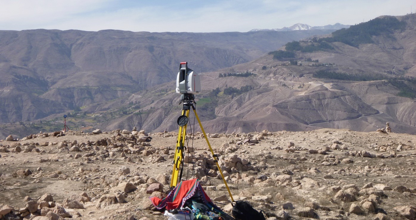
We use a range of techniques, including GIS modeling, GPR, magenometry, drone based thermal imaging, electrical resistivity, laser scanning, and dGPS positioning. Instruments presently available at ASU include a Faro GeoSlam Zeb Horizon mobile LiDAR scanner, Geometrics MagEx Cesium Vapor magnetic gradiometer, GSSI SIR-3000 Ground Penetrating Radar unit, and Emlid Reach 3D GPS base and rover.
Ancient Wari agricultural terraces (ca. 1000 CE) as imaged by the TLS in Moquegua, Peru.


Drone imagery at Cerro Baul, Peru, overlayed with magnetometry anomaly contours and thermal imaging.
SIR-2000 GPR employed at Khonko Wankane, Bolivia.


3D rendition of DEM of agrarian landscapes in southern Peru during drought period in the 7th c. CE.
Our sister lab at The Field Museum, the Anthropology Spatial Analysis Laboratory, is outfitted for advanced technological prospection and spatial analysis of archaeological remains using GIS, satellite imaging, and ground based geophysics. Resources include workstations running ArcGIS 10 and Agfasoft Photoscan for site based, regional, continental, and global geographic information systems applications. Field mapping equipment include a Phantom Vision 2 drone, a TOPCON total station and SMI data collector, as well as several WAAS and differential capable GPS units. Ground based geophysics resources include Mala Geoscience X3M instrumentation for ground penetrating radar and a GEM Systems Overhauser gradient magnetometer, as well as analytical software (ReflexW). The lab is directed by Dr. Ryan Williams.